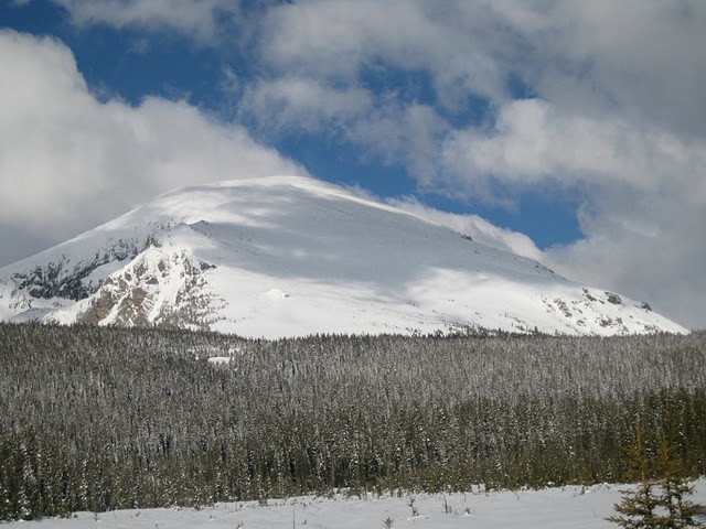
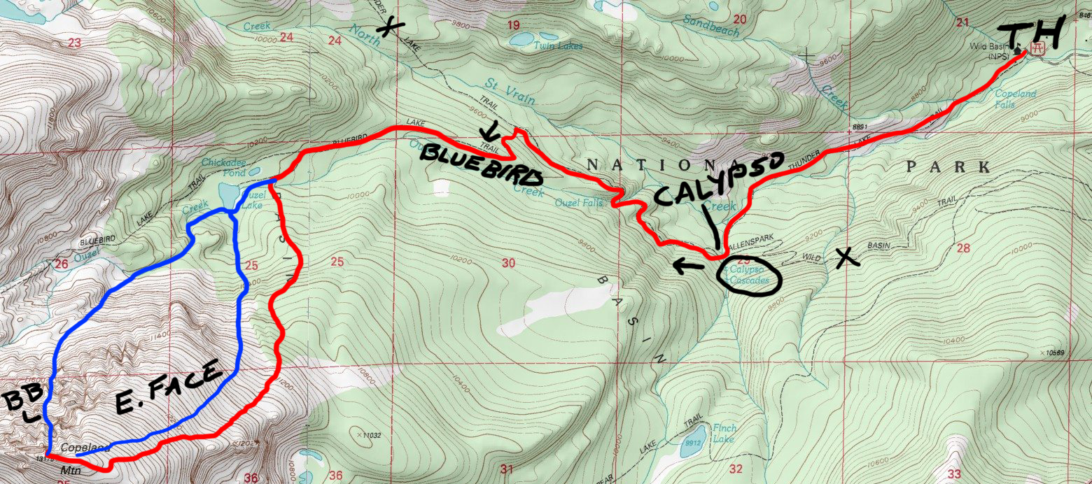
Copeland

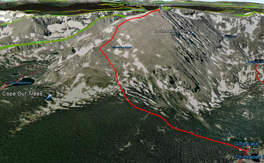
The north and east faces of Copeland tend to hold the most continuous snow, but the disparity lies in their intensity.
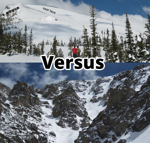
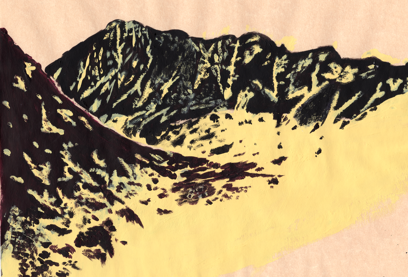
This mellow route can be seen from the Wild Basin entrance and portrays Copeland as basic and straightforward.
It's also the most direct way of reaching the summit. Simply follow the Thunder Lake Trail then the left fork onto Bluebird Lake Trail. At Ouzel lake cut directly south through the lower trees and keep uphill towards the far southeast ridgeline.
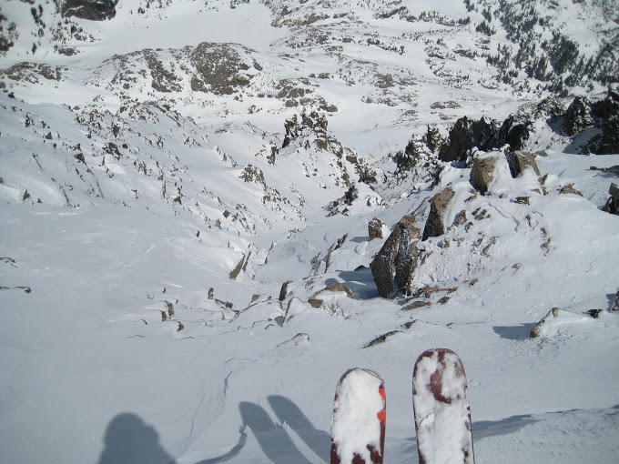
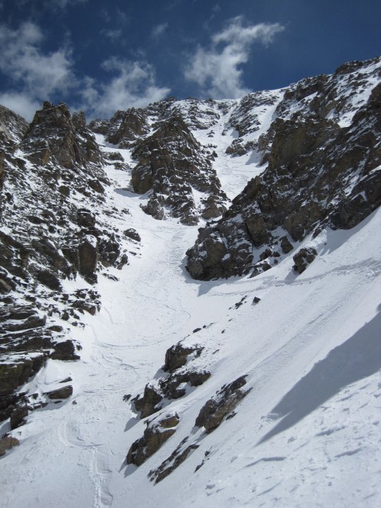
If you stay close enough to the ridge you'll see a steep couloir with a wide entrance that leads south towards Pear Reservoir. This is an un-named south facer that should be skied:
Keep making your way up the this mellow ridgeline that never gets all that steep (maybe lower 30s at most). This tops out across a long, gradual summit that's longer than you'd think. From here take a minute to soak in the views of all that Wild Basin has to offer, then make the sane and rational decision to descend the same snowfield that you just came up.
OR...
If you're up for the challenge AND there's enough snow AND you've done your homework AND know what you're in for AND have a good grasp on the snow's stability AND are sure of your skiing ability...
THEN, there's this guy:
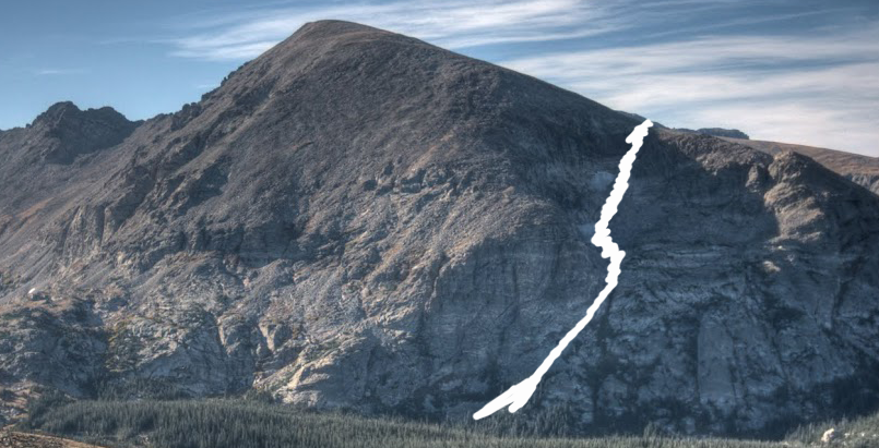
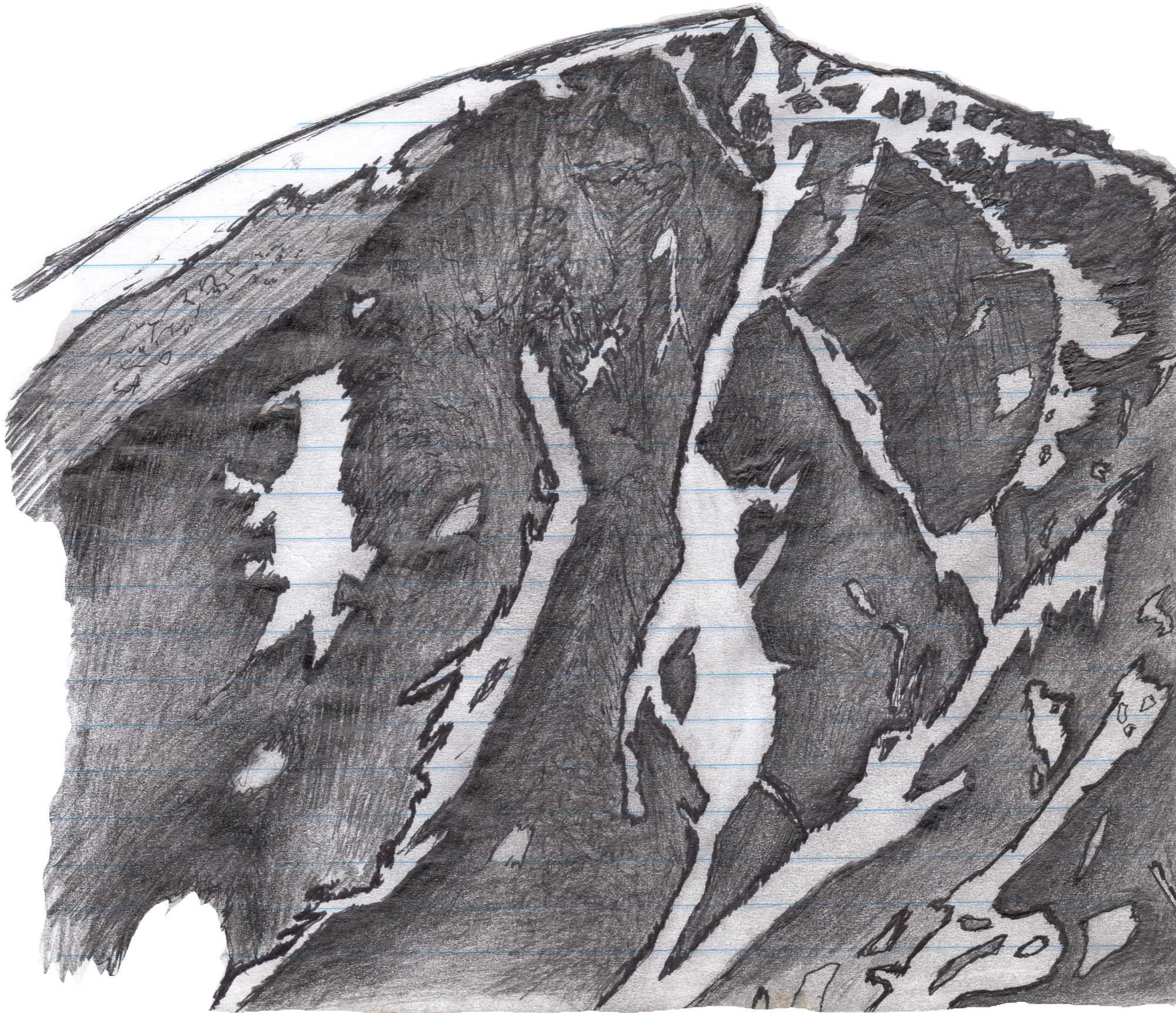
This beast of a line pieces its way down the gnarled north face of Copeland and should truly only be attempted by the most advanced ski mountaineer. In the right conditions, however it can be an outright amazing line and fully worth the added effort. From the top looking in it appears to be a steep jumbled mess of rocks and cliff faces below. And it's certainly not the kind of line you want to drop into blind.
If you're ready to take the plunge then drop straight into the prominent line from the very summit. This upper steep pitch has plenty of rocks to navigate through, some of which are right beneath the surface. To manuever the main chute you continue past these first few hundred feet (roughly two pitches) then dogleg off to skiers left. There's a largish boulder you'll need to manuever around the top of but once you're in it should be smooth sailing.
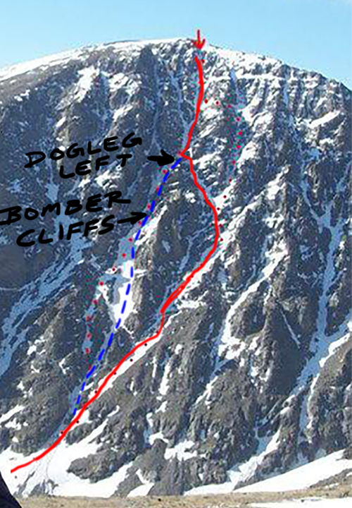
If you're tempted to instead descend straight down you should be prepared to rappel a short portion (the Bomber Cliffs) but the most bang-for-your-buck entails taking the turn.
As you keep descending this line you'll have aesthetic rock on either side for another few hundred feet, at which point things widen with a nice open apron below and a big boulder in the middle, either side of this is totally skiable, so enjoy the rest of your turns down to the lake. You earned em!
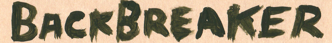
* The name of this line comes from yours truly who suffered a T5 and T6 vertebrae injury after catching an edge and tumbline many hundred yards on the upper pitch. Luckily I was wearing my helmet and had two buddies along (Daan and Jonny) who got me through a self extraction.