Long’s Peak needs no introduction. It stands as the king of the Front Range. Its blocky summit and giant cliffs tower above the urban centers of the I-25 corridor. It is a 14’er, the highest point in Wild Basin (and the Park), the most recognizable mountain in the state – it’s even on the Colorado state quarter – and a respected ski descent.Words and photos by Erik Stevens
Due to relentless strong winds, this peak is stripped of snow in even the best of winters, greatly limiting its skiing potential. The most often skied (maybe 5-10 people per year) route on Long’s is the Cables Route on the north face. The Cables Route is steep, rocky, very hard to access, and highly exposed above the looming east face. Worst of all, it is short. A huge climbing effort to reach the Cables Route gets you only about a thousand feet of skiing.
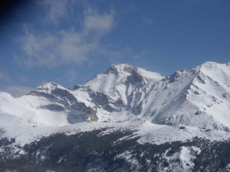
A highly preferable alternative to the Cables Route is Keplinger’s Couloir on the south face of the peak in Wild Basin. The couloir could be approached from the Keyhole Route via the Boulder Field on the north side of Long’s (skiing out Wild Basin to connect to a car shuttle), but it is much more enjoyable to climb the couloir from Wild Basin before skiing it.
Keplingers
From the Sandbeach Lake Trailhead
Approaching Long’s from Wild Basin allows you to complete an intricate and spectacular continuous ski route from the summit all the way down into the depths of Wild Basin. If timed right, there is potential for good continuous skiing all the way from the summit at 14,255ft down to 10,000ft or lower. This makes it the longest continuous ski route in the basin. Keplinger’s Couloir itself – just one part of the route – is 2,000 vertical feet of excellent 40-45 of couloir skiing.
This is a colossal day trip. To be off the steeps by the heat of the day you’ll need to leave the trailhead by 1 or 2am at the latest. The easiest approach is to follow the Sandbeach Lake trail for 4.3 miles to Sandbeach Lake (though you may end up traveling closer to 5 miles to get there). Remember that this trail is hard to follow in winter, and especially in the dark. All of your orienteering skills will be needed to make it to the lake (you will need a map, compass, and GPS).
The trail follows long switchbacks up a steep, dry ridge, and then follows through the forest across complex undulating terrain. This trail has many fallen trees, which can be a real problem if the snowpack is thin.
About 3.5 miles in you’ll find a small meadow and pond. The trail takes a right here, and this turn is very easy to miss in winter. If you’re not careful you’ll spend an extra half-hour trying to find the trail. After this point, you’ll likely lose the trail again anyway. When this happens, you’ll have to continue bushwhacking northwest towards the lake the best you can, generally tending uphill and slightly north. If you make it to the lake before dawn you should be in good shape. If things aren’t looking good at this point for a summit attempt of Long’s, Mt. Orton makes for some good pillow skiing. Its east face is 1200ft tall above Sandbeach Lake, and tends to have very good snow coverage due to wind loading.
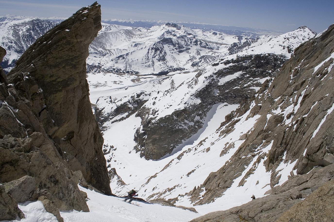
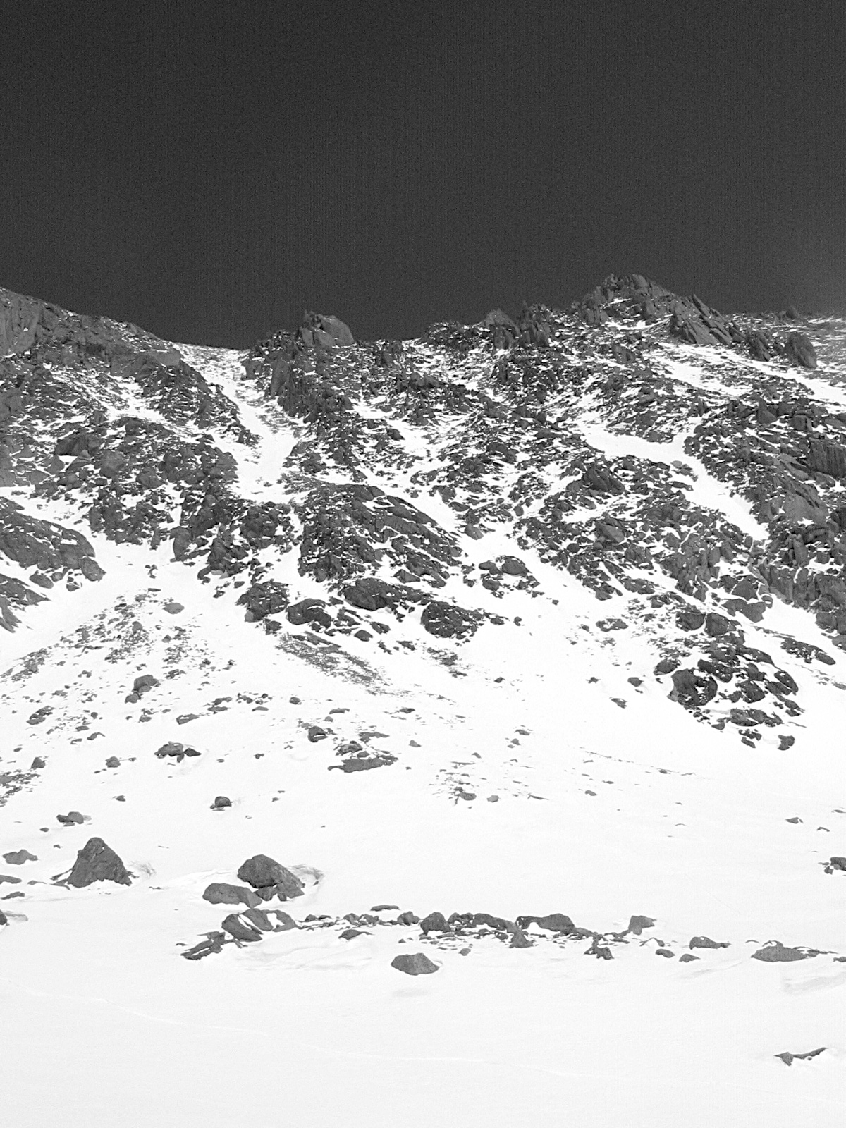
From Sandbeach Lake, skin uphill towards the Northwest. You want to parallel the long ridge known as Mt. Orton, staying below the ridge (do not climb it) and keeping it to your south. As you head up the valley between Mt. Meeker and Mt. Orton the trees will begin to thin out, giving you your first spectacular views of Pagoda’s Arabian Ridge and the Homestretch on Long’s. Continue up the valley another mile or so straight to the apron of Keplinger’s Couloir. If conditions are good and you’re feeling strong, don your ice axe and crampons and begin kicking steps up this long, curvaceous couloir. At the top of the couloir, you stand below the stunning rock spires called the Palisades. From here, turn left, following the only feasible route across the Ledge and uphill towards the Homestretch. The Ledge is a steep (40-45 o ) snow traverse just above some big cliffs. Do not attempt this traverse if the snow is not absolutely stable. This is a serious no-fall zone. One mistake on or above the ledge will mean near-certain death.
Once across the ledge you have about 400ft of roughly 44 o climbing to the summit. This straight shot uphill takes you right up the Homestretch, the final push for most routes on Long’s.
The Descent:
Regain your strength on the summit and prepare for a long, precarious, and very fun descent. If conditions allow you can reverse your route exactly. Ski down the homestretch, traversing down across the ledge to the Pallisades and down Keplinger’s Couloir. From the bottom you can ski all the way down the basin into the trees below Mt. Orton.
It’s usually easiest to stay high and skier’s-right when entering the trees on the way back towards Sandbeach Lake. You can bypass Sandbeach Lake by ski traversing just below it to the northeast. Be careful not to stray too far down into the valley skier’s-left though; it is dense and unpleasant. Once back on your skin track it’s a simple but very long ski out the way you came. Usually you cannot ski down the last mile of the trail (the final switchbacks down to the trailhead) due to very thin snow coverage.